


Department of Cartography and Geoinformatics
Address of faculty: 71 Al-Farabi Ave. Building MEB 6
Telephone of department: 8-727-221-12-74 (12-24)
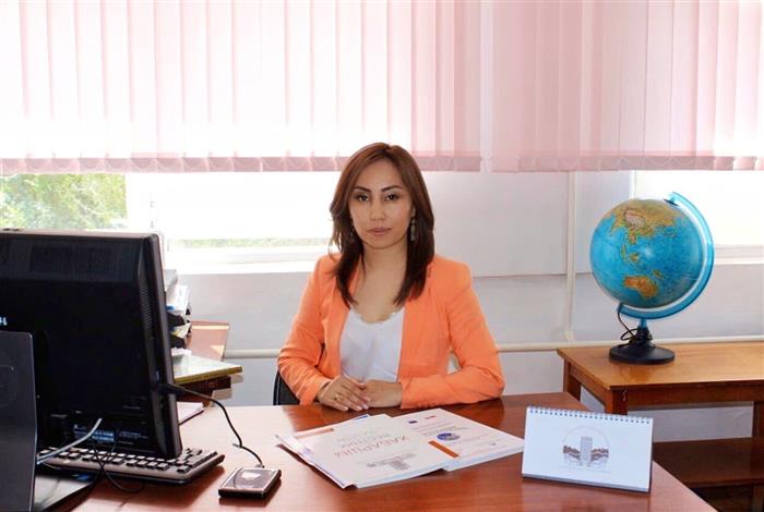 |
Head of the Cartography and Geoinformatics Department PhD, Associate Professor Telephone: 8-727-377-33-31 ex.12-74 |
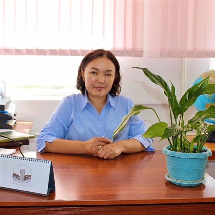 |
Deputy Head of the Department for educational, methodical and educational work Senior lecturer
Telephone: 8-727-377-33-31 ex.12-24 8-727-221-12-24 |
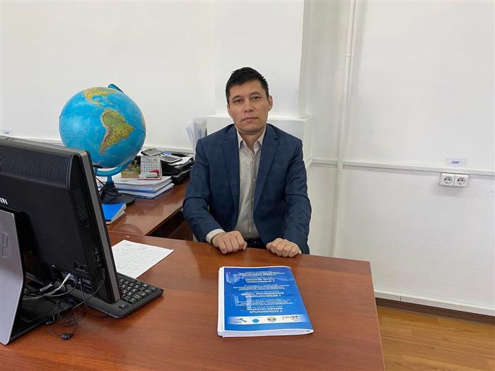 |
Deputy Head of the Department of Cartography and Geoinformatics on Scientific-innovations Work and International Relationship Candidate of Technical Sciences, Senior lecturer
Kumar Dauren |
Directions of training
|
Code of speciality |
Speciality |
Duration of study |
Qualification |
|
Bachelor |
|||
|
6В07301 |
Geodesy and cartography |
4 years |
Bachelor of Technics and Technology |
|
6В07302 |
Geoinformatics |
4 years |
Bachelor of Technics and Technology |
| 6B05206 | Natural and technogenic risks | 4 years | Bachelor of Technics and Technology |
|
Master’s Program |
|||
|
7M07301 |
Geodesy |
2 years |
Master of technical science |
|
7M07302 |
Geoinformatics |
2 years |
Master of technical science |
|
7M07303 |
Cartography |
2 years |
Master of technical science |
| 7M05210 | Natural and technogenic risks | 2 years | Master of technical science |
| 7M07307 | Big Data in Geodesy | 2 years | Master of technical science |
|
PhD |
|||
|
8D07301 |
Geodesy |
3 years |
PhD |
|
8D07302 |
Geoinformatics |
3 years |
PhD |
| 8D070303 | Cartography | 3 years | PhD |
| 8D05206 | Natural and technogenic risks | 3 years | PhD |
|
№ |
Name of the subjects |
Type of discipline (educational or elective) |
|
1 |
Geoinformatics |
Natural science (STEM) module (secondary) |
|
2 |
Mathematics in Geodesy and Cartography |
Natural science (STEM) module (secondary) |
|
3 |
spacephysics |
Natural science (STEM) module (secondary) |
|
4 |
Physical basis of optoelectronic devices |
Natural science (STEM) module (secondary) |
|
5 |
geodesy |
Basicprofessionalmodules (Secondary) |
|
6 |
Modernsurveyingequipment |
Basicprofessionalmodules (Secondary) |
|
7 |
cartography |
Basicprofessionalmodules (Secondary) |
|
8 |
Soil science |
Basicprofessionalmodules (Secondary) |
|
9 |
Basicsofinventory |
Basicprofessionalmodules (Secondary) |
|
10 |
Topographical drawing and engineering graphics |
Basicprofessionalmodules (Secondary) |
|
11 |
Engineeringsurveying |
Basicprofessionalmodules (Secondary) |
|
12 |
AutomatedDataProcessing |
Basicprofessionalmodules (Secondary) |
|
13 |
The theory of mathematical processing of geodetic measurements |
Basicprofessionalmodules (Secondary) |
|
14 |
HigherGeodesy |
Basicprofessionalmodules (Secondary) |
|
15 |
photogrammetry |
Basicprofessionalmodules (Secondary) |
|
16 |
FundamentalsofRemoteSensing |
Basicprofessionalmodules (Secondary) |
|
17 |
FundamentalsofEnvironmentalMonitoring |
Basicprofessionalmodules (Secondary) |
|
18 |
Database |
Basicprofessionalmodules (Secondary) |
|
19 |
Development and standardization of software and information technology |
Basicprofessionalmodules (Secondary) |
|
20 |
Geomorphology of the basics of geology |
Basicprofessionalmodules (Secondary) |
|
21 |
Geodynamicprocesses |
Basicprofessionalmodules (Secondary) |
|
22 |
Spaceshootingtechniques |
Basicprofessionalmodules (Secondary) |
|
23 |
Cartographic-mathematicalmodeling |
(elective) |
|
24 |
Mathematicalcartography |
(elective) |
|
25 |
Physicalbasisofmapping |
(elective) |
|
26 |
Atlasmapping |
(elective) |
|
27 |
Designandmapping |
(required) |
|
28 |
Makingcartographic |
(elective) |
|
29 |
Geomorphology of the basics of geology |
(elective) |
|
30 |
GIS mappingofKazakhstan |
(elective) |
|
31 |
Automatedprocessingaerospaceinformation |
(elective) |
|
32 |
Economics and Organization of cartography and geodesy production |
(required) |
|
33 |
Cadastralmapping |
(required) |
|
34 |
Multimedia and computer design in cartography |
(elective) |
|
35 |
Automationinthematicmapping |
(elective) |
|
36 |
Modernmethodsofmapping |
|