


INNOVATION: DIGITAL RAILWAY MODEL
Views: 2479
Geographic information systems are effective information technologies in many areas, including transportation. According to Bakhyt Sakhariev, director of the KazNU Center for Remote Sensing. Al-Farabi, transport infrastructure specialists, carriers and passengers need information about transport networks and facilities. And it's hard to say that modern maps fully meet modern requirements.
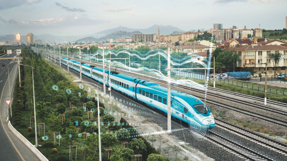
The model of the railway, presented in the form of a geographic information system (GIS), currently forms the basis of the production activities of any enterprise in this area. International experience in the field of railway operation shows that this is necessary for the current and future planning, design and operation of the railway. According to the head of the center, now there is a wide range of users who need information about transport. However, in the modern domestic railway industry there is no electronic vector map, as the specialists of KazNU believe.
“They only have a raster map (a scanned copy of the map - ed.),” Says Bakhyt Sembaevich. - And the electronic card created by us can be edited several times, published on the portal and made available to Internet users. Currently, electronic maps of roads and railways are needed not only by industry workers, but also by passengers, road repairmen, dispatchers. For example, private railway companies are controlled by the Transport Committee. In this regard, an electronic card is very useful. Because it allows you to see every inch of the railroad.
Over time, you can use satellite imagery to make new changes. The electronic map contains a database. It is easy to map stations, infrastructure and railroad crossings from the semaphore to each railroad. These are the possibilities of modern space technology. Satellites from the United States, France and China can capture 1 meter or 33 centimeters per pixel.
- In this case, we see the sleepers of any rail. When creating an electronic map, we do not use only images taken from space. In some areas, we are creating an important electronic system, integrating everything with a drone or laser. For example, a worker marks a defect on any section of the railway with a tablet on an electronic map. Thus, the dispatcher informs his situational centers. Then the leaders decide how to proceed, ”says the director.
________________
It goes without saying that these technologies can be used to optimize the amount of funds. Because experts know the length of the railway by coordinates. The company does not incur excessive costs, as it has accurate information about how many stones the railway needs, the length of the rails, and how many power lines are needed.
Currently, dispatchers determine where the train is going by informing the drivers. And through the electronic system, you can see the location of the object on the map. The amount of information allowed for each user is different. For example, the tables in the database for specialists are not available to passengers. They are provided only with information about the direction of the road, stations along the road.
- We've done it before. For example, earlier, when we shot down the Almaty-1 station from space, we got an image that could fit in 50 centimeters per pixel. So, here we can clearly see the rails. We will vectorize these frames, that is, draw lines in the picture. This requires very little space on your computer. And space images take up a lot of space. Because every point in the image is written to a file. And on a vector map, each line is written with a function in the program. For example, a satellite image can be 100-500 megabytes in size. And if you vectorize it, then there will be a maximum of 50 kilobytes. There are only three objects in vectorization: point, line, polygon. With their help, we can draw any picture on an electronic map, says Bakhyt Sakhariev.
_____________________
Specialists from the University's Remote Sensing Center have also mapped the route of the Makat - Inder - Uralsk railway. Based on this, company representatives will be able to accurately calculate the funds they need. It is also possible to calculate the relief of the railway track using satellite images. The center uses a drone to verify the accuracy of each piece of information. Thus, the customer receives clear information about how much soil needs to be dug, how much needs to be removed in order to level the grooves.
According to Mr. Bakhyt, sometimes the railway runs close to mountains and rivers. High risk of landslides and floods. Methods to avoid such an accident can be used through an electronic system.
- Also, with the help of the SuperMap program, we can create an intelligent interface for the railway - a geoportal. This geoportal is used in the situational centers of the company. And we update the data based on satellite images. The smart interface is an automated workspace. In addition to the electronic map, we will create a program based on a mathematical model and include some functions. For example, it can automatically calculate the distance between two stations. On both sides of the railway, there should be an open area where no trees grow and no houses are built. All this can be found on the geoportal. We can also register private railways in the database. We add information about the owner of the company, the certificate, the security measures used. This will significantly reduce the workload on staff, - said the head of the center.
As you know, some railways have level crossings. Some of them have no barriers. Bakhyt Sembayevich said that video surveillance could be installed at such crossings, which would strengthen security measures along the railway.
- It can be seen directly from the situational centers. You can determine in time whether the barrier is working properly or there are no stops along the railway. For example, a couple of years ago, during a traffic jam near Almaty, a bus collided with a train, resulting in a major traffic accident. If the geoportal had information through video surveillance, the dispatchers would warn the driver in time. Such infrastructure is needed to prevent emergencies, - said B. Sakhariev.
Yes, according to statistics, land transport crashes nine times more often than air transport. Therefore, to reduce the risk, it is necessary to use innovative technologies. Scientists are also proposing a solution. Our goal is to use the opportunities of new projects.
Camila Dussein