«Desertification processes in the context of climate change»
🔰 On October 24, 2023 a scientific seminar was held at the Department of Cartography and Geoinformatics on the theme: "Desertification processes in the context of climate change" under the project of young scientists AP09058590 "Monitoring of land degradation and desertification processes in Talas district of Zhambyl oblast using GIS and remote sensing data for sustainable land use" in the framework of promoting SDG 15 "Conservation of terrestrial ecosystems".
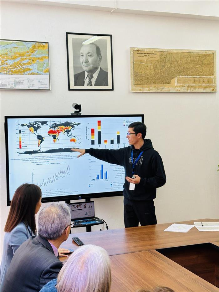
One of the most serious manifestations of land degradation is "anthropogenic desertification" caused by human activity and climate change. A large area of modern deserts is of anthropogenic origin. According to the UN, drylands cover up to 43% of the earth's surface in more than 100 countries and soil degradation has already affected 70% of the world's drylands. The rate of desertification in the world has now reached 7-10 million hectares per year. In addition, every year another 20 million hectares lose productivity due to erosion and sand encroachment. Most of the territory of Kazakhstan is located in the arid zone and about 76.1% of the territory is subjected to desertification and land degradation processes in different degrees. About 191.1 million hectares out of 273.5 million hectares of the territory of the Republic are subjected to desertification. More than 100 thousand ha are subjected to secondary salinization. The workshop presented the main results of the project based on meteorological, hydrological indicators, field studies and remote sensing data.Speaker: O.J. Taukebaev, Deputy Director General of the cluster of engineering and knowledge-intensive technologies, senior lecturer of the Department of Cartography and Geoinformatics.Seminar participants: faculty members, masters and doctoral students of the Faculty of Geography and Nature Management.